

Before you go any further...
I've read and accept the Terms of Use and the Privacy Policy.
I accept to receive newsletter and other communications associated with firms of The Explorers Network group'
I accept to receive commercial offers of The Explorers Network partners'.


Thanks!
Vote everyday for your favorite content
SENSITIVE CONTENT
This media contains sensitive content which some people may find disturbing or offensive.
You must be 15 years of age or older to view sensitive content.
Log inBirthday
Content being validated
THE EXPLORERS +
Watch our premium movies
The Explorers + is our premium movie catalog in Ultra High Definition (HD/4K/8K)! Hundreds of videos already available and daily new content on all your devices (web, mobile, tablets, smart TV).
Post content (photo or video) and get 1-month free
OR
Subscribe and support The Explorers Foundation's field actions for biodiversity.
Content being validated
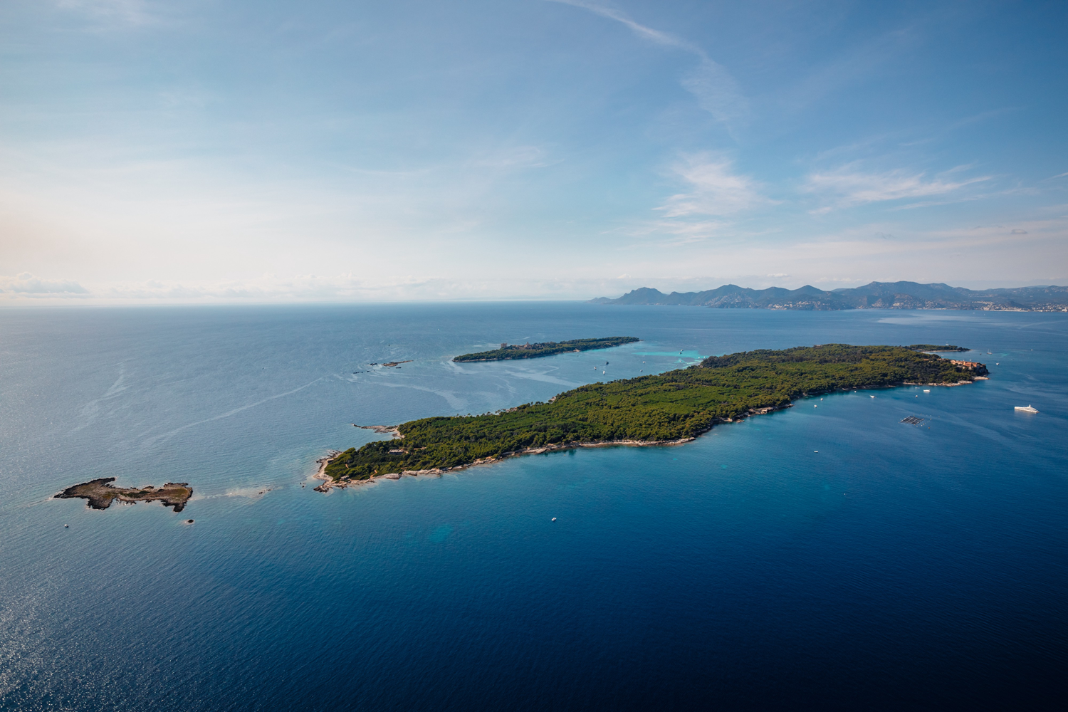
Aerial view of the Lérins Islands
0
0

Such a global aerial view of the Lérins archipelago provides a good understanding of the positioning of the islands in relation to each other. In the foreground, Sainte-Marguerite Island is the closest to the mainland, the best served, and the most visited. 2.17 miles (3.5 km) long for a maximum width of 0.6 miles (1 km), it is also the largest island of the archipelago with a 519 acres (210 ha) area. The islet of La Tradelière stands in its eastern extension. In the background, the private island of Saint-Honorat covers an area of 91 acres (37 ha) and extends over a length of 4,921 ft (1,500 m) for a width of 1,312 ft (400 m). It is accompanied by the Saint-Ferréol islet. The fifth island of the Lérins archipelago, nicknamed l'Îlot, is masked by Saint-Honorat Island.
Related content

Médias en cours d’exploration