

Before you go any further...
I've read and accept the Terms of Use and the Privacy Policy.
I accept to receive newsletter and other communications associated with firms of The Explorers Network group'
I accept to receive commercial offers of The Explorers Network partners'.


Thanks!
Vote everyday for your favorite content
SENSITIVE CONTENT
This media contains sensitive content which some people may find disturbing or offensive.
You must be 15 years of age or older to view sensitive content.
Log inBirthday
Content being validated
THE EXPLORERS +
Watch our premium movies
The Explorers + is our premium movie catalog in Ultra High Definition (HD/4K/8K)! Hundreds of videos already available and daily new content on all your devices (web, mobile, tablets, smart TV).
Post content (photo or video) and get 1-month free
OR
Subscribe and support The Explorers Foundation's field actions for biodiversity.
Content being validated
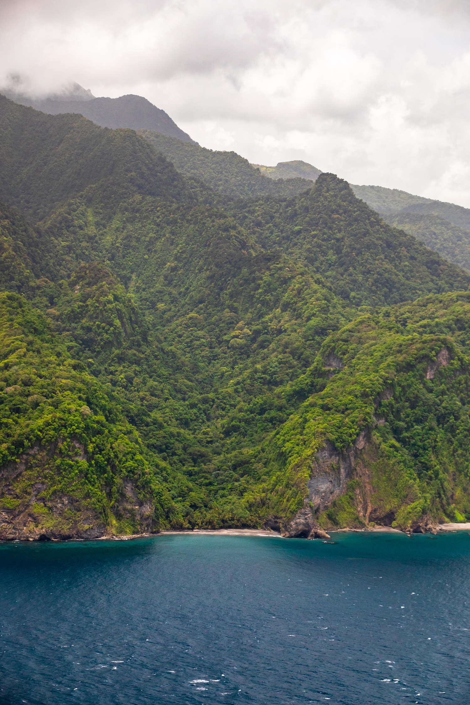
An island with three mountain ranges
2
0

Martinique is a mountainous island home to three main massifs. Two are located in the northern part of the island, Mount Pelée (4,583 ft / 1,397 m) in the municipality of Morne-Rouge as well as the Pitons du Carbet (3,927 ft / 1,197 m) in Morne-Vert, and one in its southern part, the Vauclin mountain (1,653 ft / 504 m) on the eponymous locality. To the far north, Mount Pelée (photo) is the best known of the three as the highest point in Martinique and for its eruptions. That of 1902 went down in history as the deadliest of the 20th century by completely destroying the town of Saint-Pierre and killing more than 30,000 people, one-fifth of the island's population at the time. A dormant volcano since the eruption of 1929-1932, Mount Pelée is, however, still not extinct. North of Fort-de-France, the Pitons du Carbet constitute a set of five volcanic peaks very close to each others: Piton Lacroix (3,923 ft / 1,196 m), Piton de l'Alma (3,625 ft / 1,105 m), Piton Dumauzé (3,638 ft / 1,109 m), Piton Boucher (3,510 ft / 1,070 m), and Morne Piquet (3,805 ft / 1,160 m). Easier to access and covered with mesophilic and humid forests, the Vauclin mountain forms a mountain range of 138 acres (54 ha) which constitutes the highest point in southern Martinique.
Related content

Médias en cours d’exploration