

Before you go any further...
I've read and accept the Terms of Use and the Privacy Policy.
I accept to receive newsletter and other communications associated with firms of The Explorers Network group'
I accept to receive commercial offers of The Explorers Network partners'.


Thanks!
Vote everyday for your favorite content
SENSITIVE CONTENT
This media contains sensitive content which some people may find disturbing or offensive.
You must be 15 years of age or older to view sensitive content.
Log inBirthday
Content being validated
THE EXPLORERS +
Watch our premium movies
The Explorers + is our premium movie catalog in Ultra High Definition (HD/4K/8K)! Hundreds of videos already available and daily new content on all your devices (web, mobile, tablets, smart TV).
Post content (photo or video) and get 1-month free
OR
Subscribe and support The Explorers Foundation's field actions for biodiversity.
Content being validated
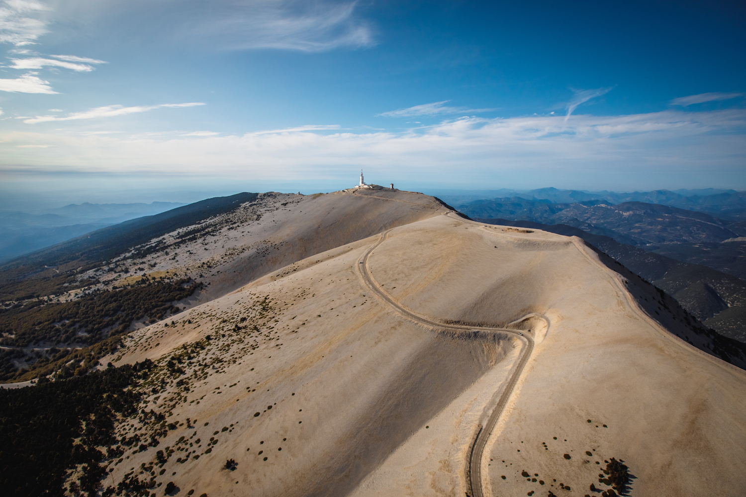
The three roads of Mont Ventoux
0
0

The summit of Mont Ventoux is accessible by three roads - departing from Bédoin, Malaucène, and Sault - well known to cycling enthusiasts. The most accessible route starts from Sault by the departmental road or Route du Ventouret with 3,608 ft (1,100 m) of elevation gain and a slope of only 3.5%. The legendary ascent of the Tour de France starts from Bédoin, in the south, and has 5,321 ft (1,622 m) of elevation gain. 13.4 miles (21.6 km) long with slopes oscillating between 7.4 and 10%, this so-called Route de l'Observatoire was inaugurated in 1882. As for the northern side from Malaucène, it offers an elevation gain of 5,036 ft (1,535 m) with a slope of 7.5% by the 13 miles (21 km) long Route du Mont Serein inaugurated in 1932.
Related content

Médias en cours d’exploration