

Before you go any further...
I've read and accept the Terms of Use and the Privacy Policy.
I accept to receive newsletter and other communications associated with firms of The Explorers Network group'
I accept to receive commercial offers of The Explorers Network partners'.


Thanks!
Vote everyday for your favorite content
SENSITIVE CONTENT
This media contains sensitive content which some people may find disturbing or offensive.
You must be 15 years of age or older to view sensitive content.
Log inBirthday
Content being validated
THE EXPLORERS +
Watch our premium movies
The Explorers + is our premium movie catalog in Ultra High Definition (HD/4K/8K)! Hundreds of videos already available and daily new content on all your devices (web, mobile, tablets, smart TV).
Post content (photo or video) and get 1-month free
OR
Subscribe and support The Explorers Foundation's field actions for biodiversity.
Content being validated
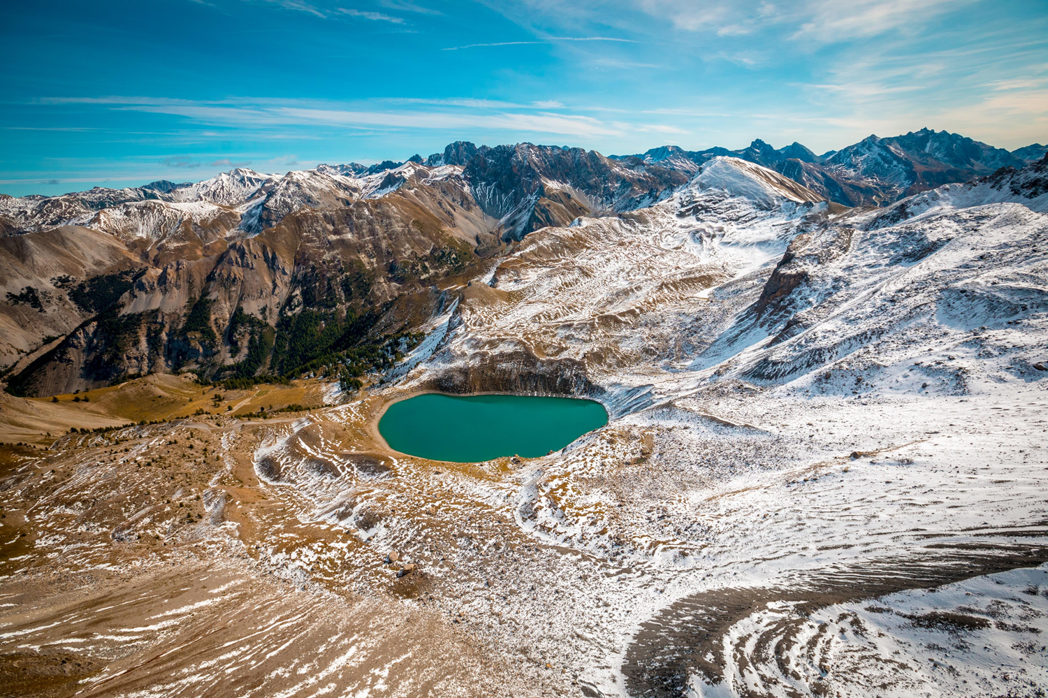
The goal of an annual hike
0
0

The route taken by the annual Sainte-Anne procession to reach the chapel erected on the edge of the eponymous lake allows a family hike from Ceillac. It follows a PR-type path to reach the lake in a maximum of 2h20 after 1,466 ft (447 m) of elevation gain. 1.8 mi (3.5 km) long, it starts from the Chaurionde car park at an altitude of 6,453 ft (1,967 m) and climbs to 7,919 ft (2,414 m). A more complete but more difficult tour combines the lakes Miroir and Sainte-Anne by taking the GR5 (Grande Traversée des Alpes) over 7.1 mi (11.5 km) and 2,460 ft (750 m) of elevation gain.
Related content

Médias en cours d’exploration