

Before you go any further...
I've read and accept the Terms of Use and the Privacy Policy.
I accept to receive newsletter and other communications associated with firms of The Explorers Network group'
I accept to receive commercial offers of The Explorers Network partners'.
Thanks!
Vote everyday for your favorite content
SENSITIVE CONTENT
This media contains sensitive content which some people may find disturbing or offensive.
You must be 15 years of age or older to view sensitive content.
Log inBirthday
Content being validated
THE EXPLORERS +
Watch our premium movies
The Explorers + is our premium movie catalog in Ultra High Definition (HD/4K/8K)! Hundreds of videos already available and daily new content on all your devices (web, mobile, tablets, smart TV).
Post content (photo or video) and get 1-month free
OR
Subscribe and support The Explorers Foundation's field actions for biodiversity.
Content being validated
To monitor the desert and the coast
0
0

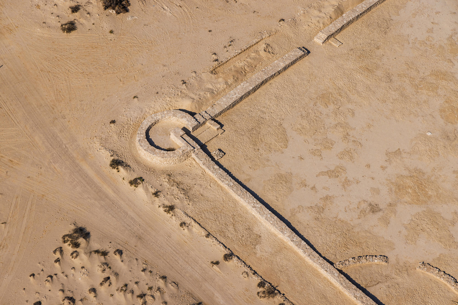
Zekreet Fort, partially visible in this aerial photograph, is located at the southern end of Zekreet Bay, which borders the small peninsula near the city of Dukhan (Qatar) on the Bahrain Gulf. The site includes the ruins of two built structures, a fort and a ‘madabi’ (date press), as well as traces of an intermediate camp area. The ensemble occupies an area of 59,055 ft² or 18,000 m² (656 ft or 200 m by 295 ft or 90 m). The quadrangular fort measures approximately 164 ft (50 m) on each side and has three circular towers and one rectangular tower (added later). The unsophisticated techniques used in its construction show that the fortified building was not a truly defensive structure. It was more a place to keep an eye on the surrounding desert – such as the Ras Abrouk peninsula with its creeks suitable for dhows – and on movements at sea (passage of merchant ships and pirates).
Related content

Médias en cours d’exploration