

Before you go any further...
I've read and accept the Terms of Use and the Privacy Policy.
I accept to receive newsletter and other communications associated with firms of The Explorers Network group'
I accept to receive commercial offers of The Explorers Network partners'.


Thanks!
Vote everyday for your favorite content
SENSITIVE CONTENT
This media contains sensitive content which some people may find disturbing or offensive.
You must be 15 years of age or older to view sensitive content.
Log inBirthday
Content being validated
THE EXPLORERS +
Watch our premium movies
The Explorers + is our premium movie catalog in Ultra High Definition (HD/4K/8K)! Hundreds of videos already available and daily new content on all your devices (web, mobile, tablets, smart TV).
Post content (photo or video) and get 1-month free
OR
Subscribe and support The Explorers Foundation's field actions for biodiversity.
Content being validated
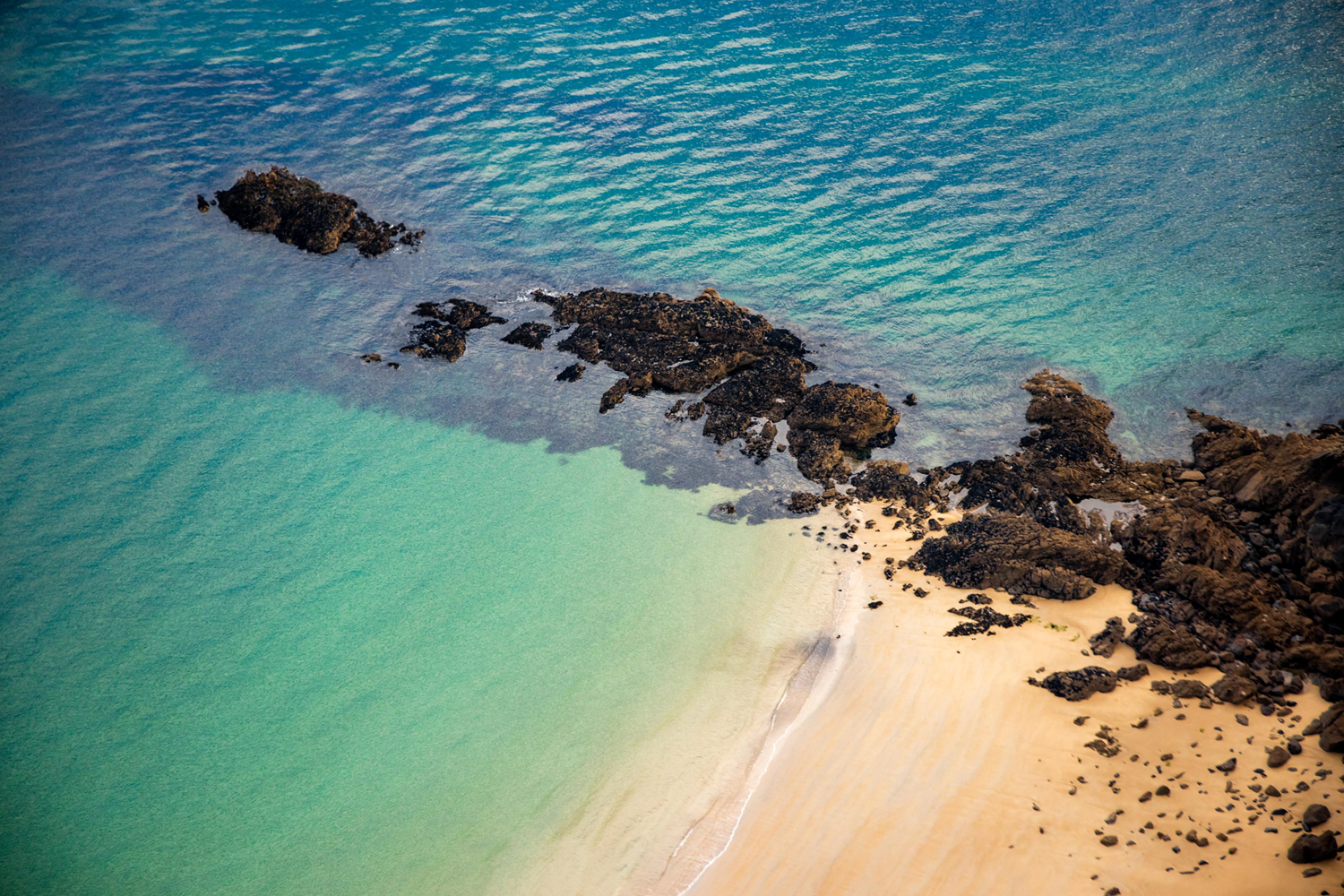
The geological morphology of the Emerald Coast
1
0

The Emerald Coast, which extends from east to west from Pointe du Grouin in Cancale to Cap Fréhel in Plévenon, is generally represented by an alternation of rocky points framing dune systems located at the base of these rocky escarpments and constituting the outlet of micro-watersheds, larger mudflats or artificialized rias. Very varied, it alternates exposed and sheltered areas made up of sandy and rocky foreshores, with large rocky complexes and large bays fed by small rivers, not forgetting the archipelagos and outcropping rocky reefs. Consisting of 60% of rocky cliffs, this coastline has only 6% of low coasts composed of mostly sandy materials, as here in the commune of Dinard (Ille-et-Vilaine).
Related content

Médias en cours d’exploration