

Before you go any further...
I've read and accept the Terms of Use and the Privacy Policy.
I accept to receive newsletter and other communications associated with firms of The Explorers Network group'
I accept to receive commercial offers of The Explorers Network partners'.


Thanks!
Vote everyday for your favorite content
SENSITIVE CONTENT
This media contains sensitive content which some people may find disturbing or offensive.
You must be 15 years of age or older to view sensitive content.
Log inBirthday
Content being validated
THE EXPLORERS +
Watch our premium movies
The Explorers + is our premium movie catalog in Ultra High Definition (HD/4K/8K)! Hundreds of videos already available and daily new content on all your devices (web, mobile, tablets, smart TV).
Post content (photo or video) and get 1-month free
OR
Subscribe and support The Explorers Foundation's field actions for biodiversity.
Content being validated
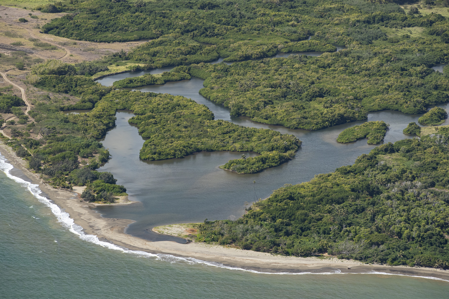
Houaïlou river
2
0

Until the construction of the Koné-Tiwaka transverse road, the Houaïlou river valley was the only crossing route from Nouméa and Bourail on the west coast to the east coast via the Roussettes pass. The eponymous village is located at the mouth of the Houaïlou river, which is partially shown in this aerial view. Located on the eastern slope of Grande-Terre, this coastal river has its source in the Mé Maoya. It has a watershed of 211sqmi (340km2) - the 3rd of the island - and an average flow of 16ft3/s (5m3/s).
Related content

Médias en cours d’exploration