

Before you go any further...
I've read and accept the Terms of Use and the Privacy Policy.
I accept to receive newsletter and other communications associated with firms of The Explorers Network group'
I accept to receive commercial offers of The Explorers Network partners'.


Thanks!
Vote everyday for your favorite content
SENSITIVE CONTENT
This media contains sensitive content which some people may find disturbing or offensive.
You must be 15 years of age or older to view sensitive content.
Log inBirthday
Content being validated
THE EXPLORERS +
Watch our premium movies
The Explorers + is our premium movie catalog in Ultra High Definition (HD/4K/8K)! Hundreds of videos already available and daily new content on all your devices (web, mobile, tablets, smart TV).
Post content (photo or video) and get 1-month free
OR
Subscribe and support The Explorers Foundation's field actions for biodiversity.
Content being validated
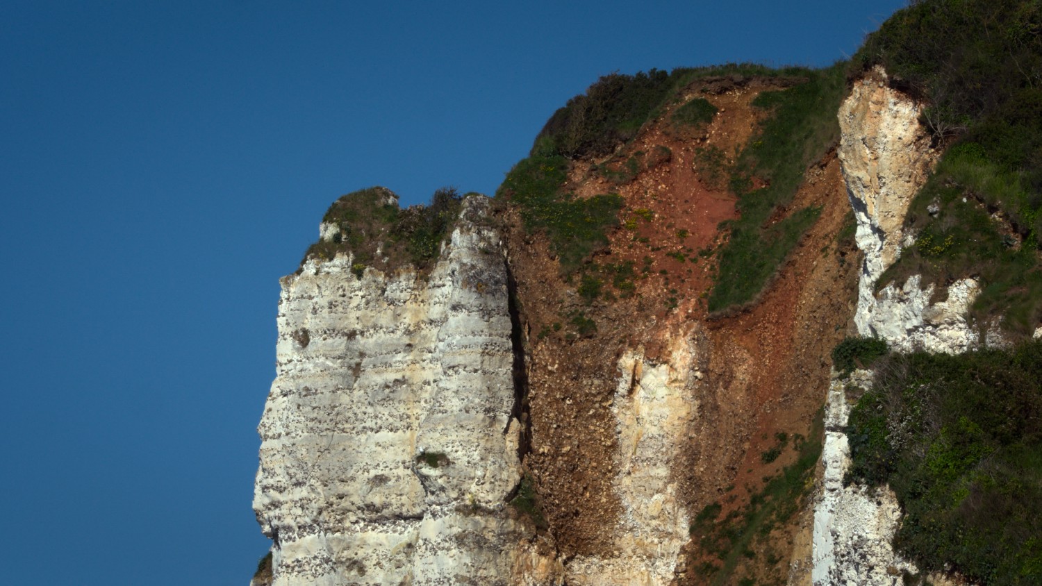
Cliffs under surveillance
0
0

The CEREMA (Center for studies and expertise on risks, the environment, mobility, and planning) and the DDTM (Departmental Directorate for Territories and the Sea) closely monitor the erosion of the 80 miles (130 km) of the Côte d'Albâtre (Alabaster Coast). The course of the GR21, which follows the cliffs, had to be modified as it stood too close to the edge after rockslides. The study of old documents and photos such as staff maps from the 2nd World War, postcards from the beginning of the century, and even paintings by artists are all indicators that allow predicting the dangers for the populations living on the cliffs.
Related content

Médias en cours d’exploration