

Before you go any further...
I've read and accept the Terms of Use and the Privacy Policy.
I accept to receive newsletter and other communications associated with firms of The Explorers Network group'
I accept to receive commercial offers of The Explorers Network partners'.


Thanks!
Vote everyday for your favorite content
SENSITIVE CONTENT
This media contains sensitive content which some people may find disturbing or offensive.
You must be 15 years of age or older to view sensitive content.
Log inBirthday
Content being validated
THE EXPLORERS +
Watch our premium movies
The Explorers + is our premium movie catalog in Ultra High Definition (HD/4K/8K)! Hundreds of videos already available and daily new content on all your devices (web, mobile, tablets, smart TV).
Post content (photo or video) and get 1-month free
OR
Subscribe and support The Explorers Foundation's field actions for biodiversity.
Content being validated
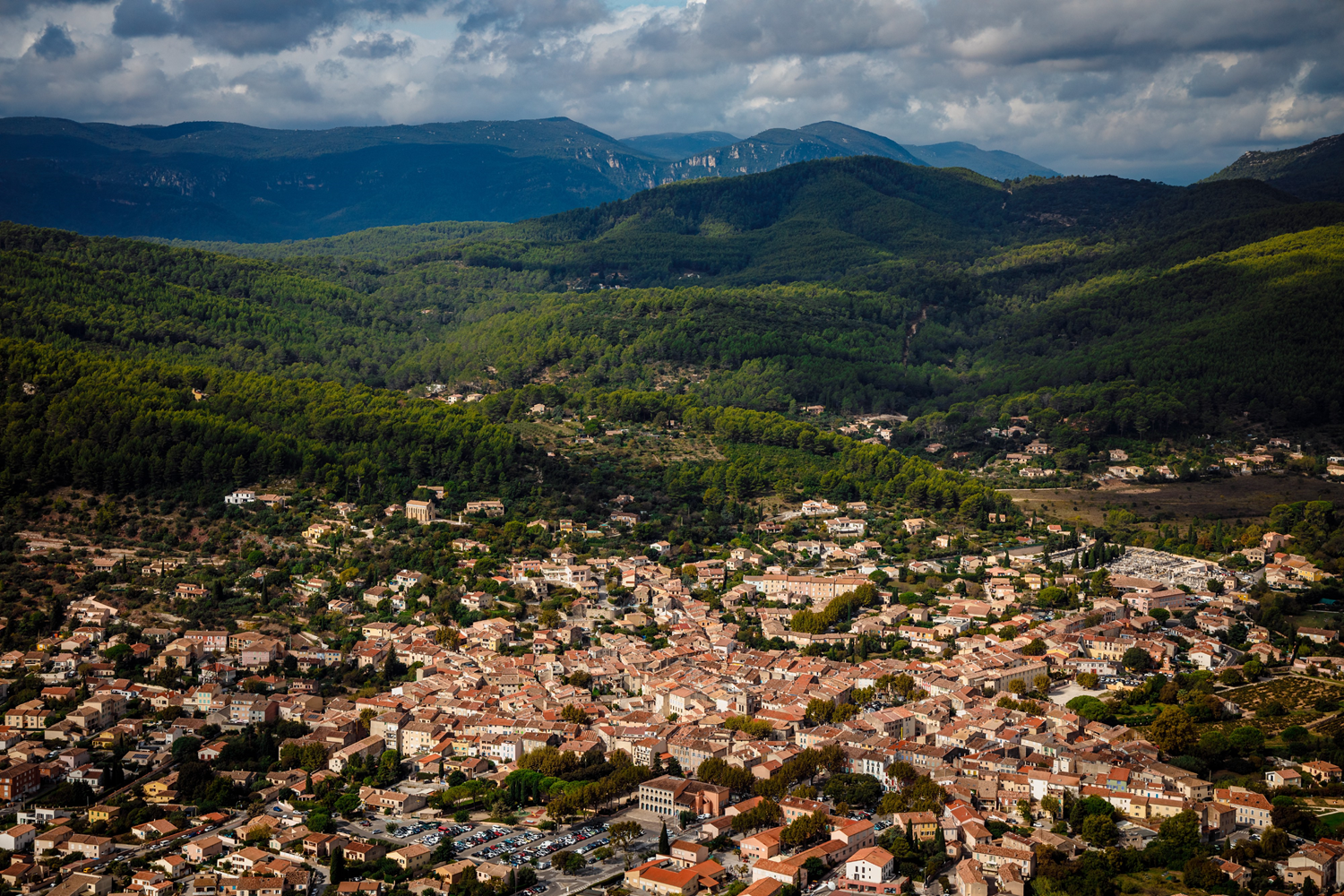
Between the Mediterranean and the Maures Massif
0
0

The territory of the municipality of Cuers, in the Var department, covers an area of 31.3 sqm (50.53 km²). It rises from 233 to 2,296 ft (71 to 700 m) above sea level between the Mediterranean Sea and the Maures Massif. The locality includes the Barre de Cuers, a mountain that constitutes the highest point of the Maures Massif at Pilon Saint-Clément. The village itself extends at an average altitude of 456 ft (139 m).
Related content

Médias en cours d’exploration