

Before you go any further...
I've read and accept the Terms of Use and the Privacy Policy.
I accept to receive newsletter and other communications associated with firms of The Explorers Network group'
I accept to receive commercial offers of The Explorers Network partners'.


Thanks!
Vote everyday for your favorite content
SENSITIVE CONTENT
This media contains sensitive content which some people may find disturbing or offensive.
You must be 15 years of age or older to view sensitive content.
Log inBirthday
Content being validated
THE EXPLORERS +
Watch our premium movies
The Explorers + is our premium movie catalog in Ultra High Definition (HD/4K/8K)! Hundreds of videos already available and daily new content on all your devices (web, mobile, tablets, smart TV).
Post content (photo or video) and get 1-month free
OR
Subscribe and support The Explorers Foundation's field actions for biodiversity.
Content being validated
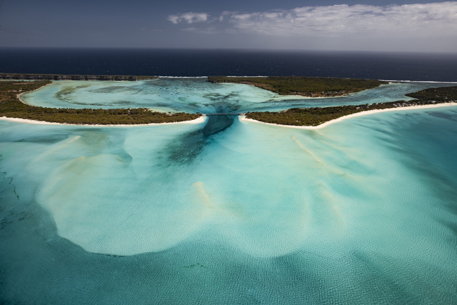
Around Mouli bridge
0
0

This aerial shot of the south of Ouvéa atoll makes it possible to clearly distinguish the different geographic components of this area. In the foreground, behind the turquoise waters of the lagoon, stands Mouli bridge which links Mouli peninsula on the right to the atoll's main island on the left. In the center, Lékiny Bay is closed by the limestone cliffs on the left. Behind the bridge, the islet of Fayawa is surrounded on the left by the Lifou pass and on the right by the Calédonie pass. In the background, the dark blue of the ocean contrasts with the colors of the lagoon and bay.
Related content

Médias en cours d’exploration