

Before you go any further...
I've read and accept the Terms of Use and the Privacy Policy.
I accept to receive newsletter and other communications associated with firms of The Explorers Network group'
I accept to receive commercial offers of The Explorers Network partners'.


Thanks!
Vote everyday for your favorite content
SENSITIVE CONTENT
This media contains sensitive content which some people may find disturbing or offensive.
You must be 15 years of age or older to view sensitive content.
Log inBirthday
Content being validated
THE EXPLORERS +
Watch our premium movies
The Explorers + is our premium movie catalog in Ultra High Definition (HD/4K/8K)! Hundreds of videos already available and daily new content on all your devices (web, mobile, tablets, smart TV).
Post content (photo or video) and get 1-month free
OR
Subscribe and support The Explorers Foundation's field actions for biodiversity.
Content being validated
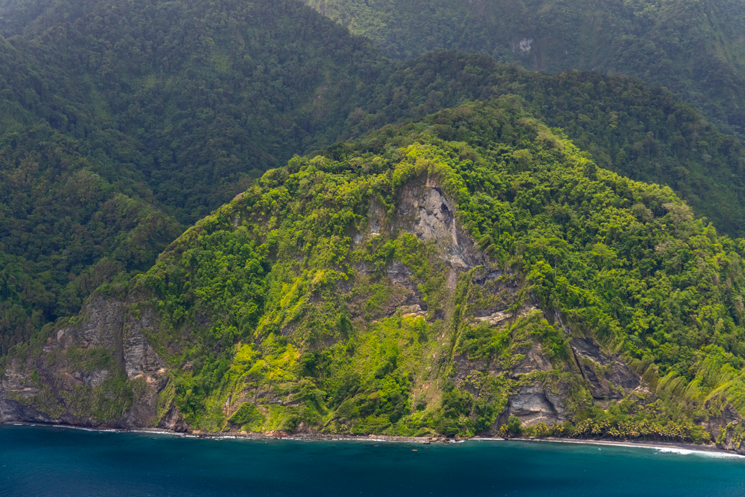
An island with a turbulent geological history
1
0

Martinique is located around 14°30' of north latitude and 61° of west longitude in the heart of the Lesser Antilles arc that separates the Caribbean Sea from the Atlantic Ocean. It was named by Christopher Columbus, who landed there on his fourth expedition in 1502 on Saint Martin's Day. Its area of 700 square miles (1,128 km²), the size of a small French department, is 90 % covered by volcanic deposits that leave only 10 % of the territory to limestone sediments and quaternary formations. Martinique's turbulent geological history results from its particular position at the convergence between two West Indian arcs that diverge to the north: one towards Anguilla via Grande-Terre de Guadeloupe, Saint-Barthélemy, and Saint-Martin; the other to Saba via Basse-Terre de Guadeloupe. It is responsible for its varied reliefs: high in the young northwestern part of the island visible here, where they culminate at Mount Pelée (4,583 ft / 1,397 m), but barely exceeding 1,640 ft (500 m) in the south, at the Vauclin mountain.
Related content

Médias en cours d’exploration