

Before you go any further...
I've read and accept the Terms of Use and the Privacy Policy.
I accept to receive newsletter and other communications associated with firms of The Explorers Network group'
I accept to receive commercial offers of The Explorers Network partners'.


Thanks!
Vote everyday for your favorite content
SENSITIVE CONTENT
This media contains sensitive content which some people may find disturbing or offensive.
You must be 15 years of age or older to view sensitive content.
Log inBirthday
Content being validated
THE EXPLORERS +
Watch our premium movies
The Explorers + is our premium movie catalog in Ultra High Definition (HD/4K/8K)! Hundreds of videos already available and daily new content on all your devices (web, mobile, tablets, smart TV).
Post content (photo or video) and get 1-month free
OR
Subscribe and support The Explorers Foundation's field actions for biodiversity.
Content being validated
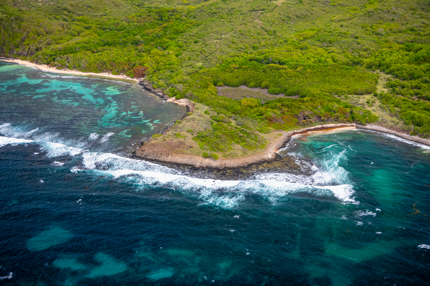
A wooded area lined with wild beaches
0
0

This aerial shot reveals part of the south Atlantic coast of the municipality of Sainte-Anne at the southern end of Martinique. It allows discovering more precisely the area located immediately south of Cap Ferré between Anse Poirier and Anse la Balle. This very wooded area lined by relatively wild beaches alternating with low cliffs is crossed by the Trace des Caps trail that runs through the southeast of the island for 17.3 miles (28 km). It is covered by one of the Littoral state forests that occupy a total of 4,512 acres (1,826 ha) and border 149 miles (240 km), i.e 50% of the coastline.
Related content

Médias en cours d’exploration